Search This Blog

Sunday 28 January 2018

Review: Wahoo ELEMNT GPS Bike Computer


Wahoo ELEMNT

You’ve probably heard of the ELEMNT already, Wahoo’s attempt at breaking Garmin’s near monopoly on bike GPS computers. I’m not going to delve into every feature that it has to offer, but I’ll fill you in with my ownership experience so far.

GPS Experiences to date

Over the years I’ve owned a number of Garmins, first the Edge 200, Dakota 20, Edge 500 and most recently the Edge 810. I progressed through the various models as my requirements for more sensors, mapping or convenience changed. It irked somewhat that despite being made by the same manufacturer, they all employed different user interfaces. Still, I could forgive that as long as they reliably tracked my data, or showed me the way to go in all sorts of nasty conditions while strapped to the bars. After all, isn’t this their raison d’être?

Typical Element data screen

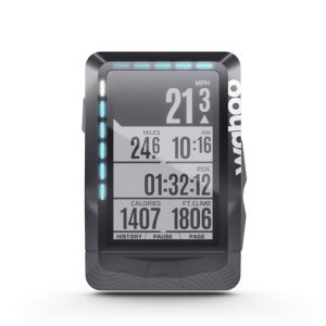
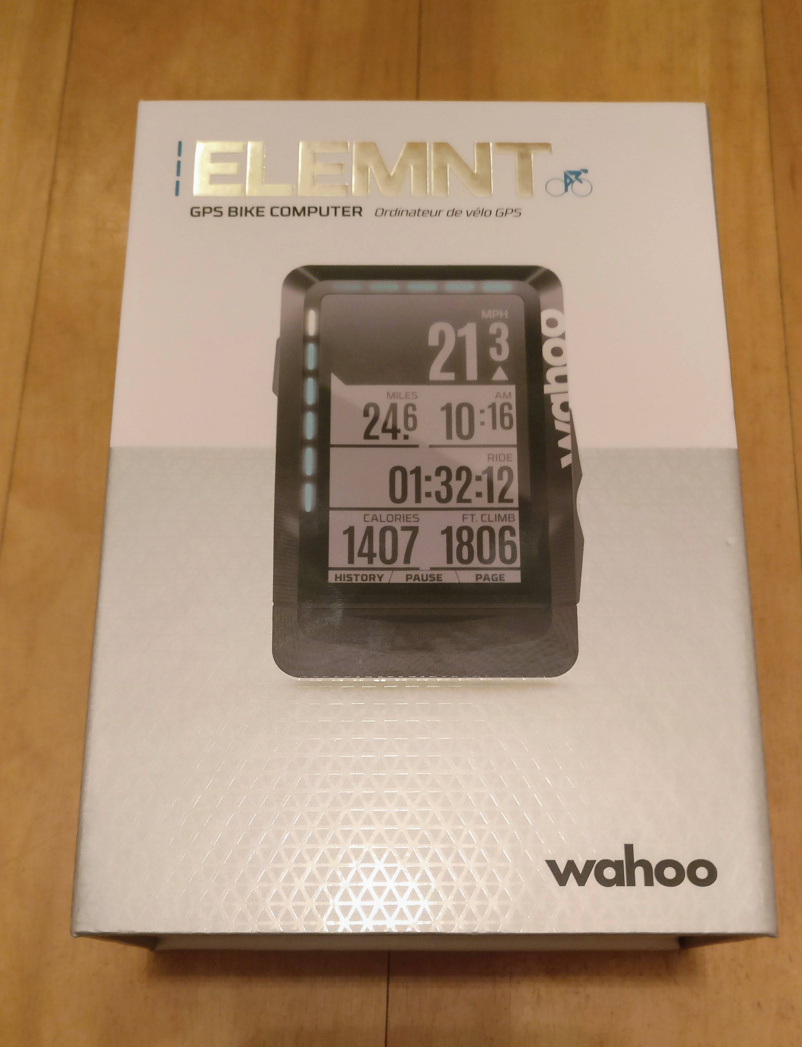
Typical Element data screen with configurable LEDS illuminated

All was well until I returned from the Tour Divide and applied a series of updates. The only reliable feature was that now it would crash whenever I rode further than my commute!

Is that a flaky GPS or am I pleased to  meet you?

At the first Audax I entered, I discovered a fellow rider who had suffered in a similar fashion with his old Garmin. He’d recently bought a Wahoo and had been delighted with it. Perhaps sensing the end was nigh, my Garmin behaved on this ride but I did pick up a wingman on the way as his Garmin had failed and he needed someone to follow!

Initial setup and user interface

So what do you need to know? Well, setup is a world away from the 810. You simply switch on your ELEMNT, open the companion app on your smartphone and scan the QR code on the ELEMNT screen. With the devices paired, simply select the pages/screens you want. On each one, check a box against the data fields you want displayed and bingo!

This interface is super easy and great for making quick changes, e.g. you want distance covered for an audax so you are know when to look for controls, or if racing you want distance remaining so you know when to go for broke!

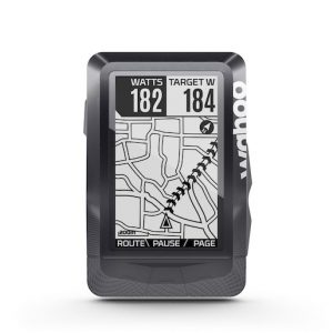
Mapping and navigation

Helpfully Wahoo include Open Street Maps for the entire world with the Element (excluding  Russia and China). They have omitted to leave more storage space for ride data but can be downloaded (free of charge) should you need them.

To add a route you can sync one previously created on Komoot or Ride with GPS  or you can use the companion app on your smartphone. The latter  is a quick and painless process. If you created the routes yourself, using Komoot, RWGPS, or the app, then you automatically get “turn by” route cues  at appropriate moments while navigating.

Elemnt map screen

In practice, UK Maps are more detailed with place names, etc featured.

My only misgivings using the app to generate routes in the UK feeds back to our vague rights of way. Wahoo can select trails that while perfectly legal, may be ill suited to your bike. Finding a chewed up bridleway mid way through your road ride isn’t always welcome!

Where am I?

The ELEMNT is not a touch screen device. You cannot pan across the map and are restricted to  zooming in and out. TIf you want to divert from your chosen route (to avoid the bridleway or to go for supplies) navigation becomes tricky with the map detail degrading progressively as you zoom out.

The map detail is perfectly sufficient when following your chosen route. Buildings aren’t shown but roads, bridleways, footpaths, and bodies of water are. The maps themselves are monochrome but in practice this renders them clearer than some maps that can be cluttered with detail.

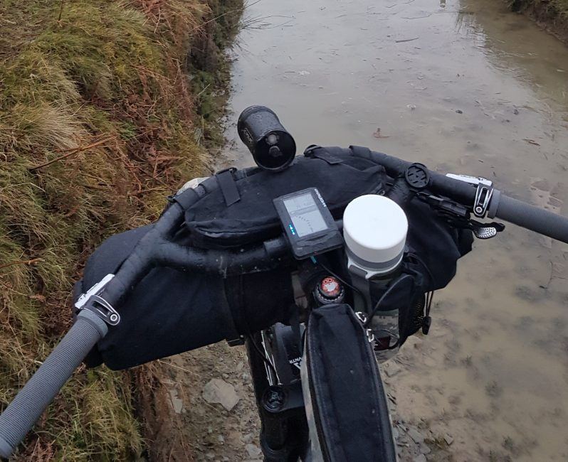
There are also two sets of LEDS on the device bezel. One is set horizontally along the top, and the other vertically along the left hand side. These can be configured to display a variety of data. Mine are set so the horizontal set flash green/red when joining/leaving a route and flash white towards the direction I need to be turning at the next cue. The vertical LEDS light up in progressively warmer colours to indicate my heart rate zones.

Battery life

Battery life  is very good as the monochrome display does not chew up the watts. The backlight can be configured to further improve life, via the app. As the ELEMNT pairs with your smartphone for data transfer the micro usb port is solely for charging purposes.  The ELEMNT has no trouble running from a battery pack and doesn’t do the Garmin trick of switching off when being fully charged or if the battery pack runs out!

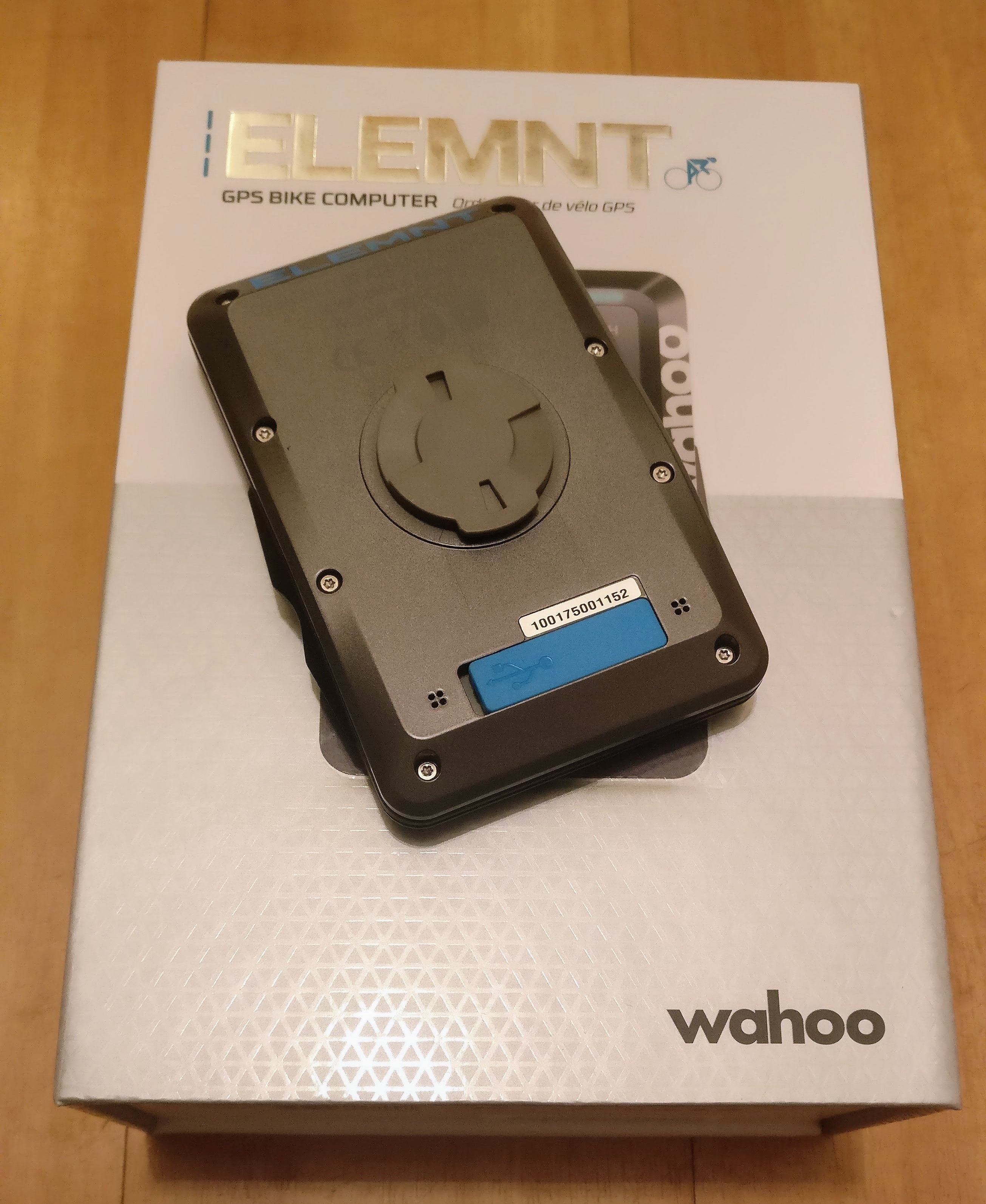
Physical controls and mounting system

Element mounts

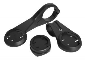
The mounts included with the Elemnt

The buttons on the ELEMNT are all easy to operate, even when wearing gloves, and the mounting system is just as good as the Garmin quarter-turn its clearly copied, I mean was inspired, by. In the box you get not only an out-front and a stem mount but an aero-bar mount too.

The stem mount attaches with zip-ties which isn’t as handy as rubber o-rings should you need to move it onto another bike. The other mounts affix with regular hex bolts and captive nuts.

Scratchy Screen

One thing we have noticed during our testing is that the screen does scratch easily – though this pretty much applies to any screen used in an outdoor environment. Before you venture outside with your new Wahoo, do yourself a favour and order a screen protector. For just £3.98 including UK delivery, the BROTECT AirGlass from Amazon is great value and will save your device from unwanted scratches.

Reliability

Reliability wise the Wahoo has yet to let me down. The closest it has come was on London-Edinburgh-London when I forgot to plug in the USB battery pack and it ran flat in the Pennines. With the pack connected it promptly switched back on displayed a “recovering ride” message and within a short time was up and running as if nothing had happened. No data was lost whatsoever.

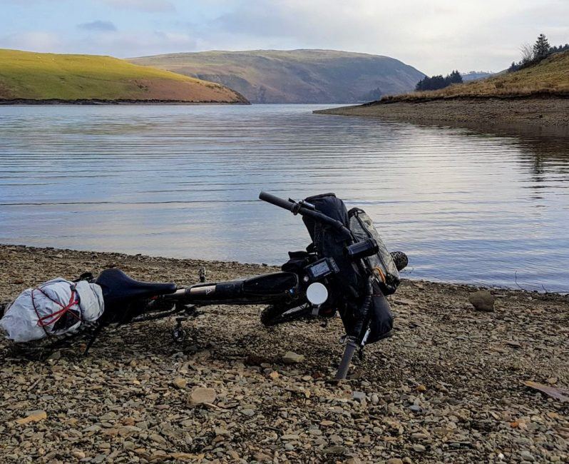
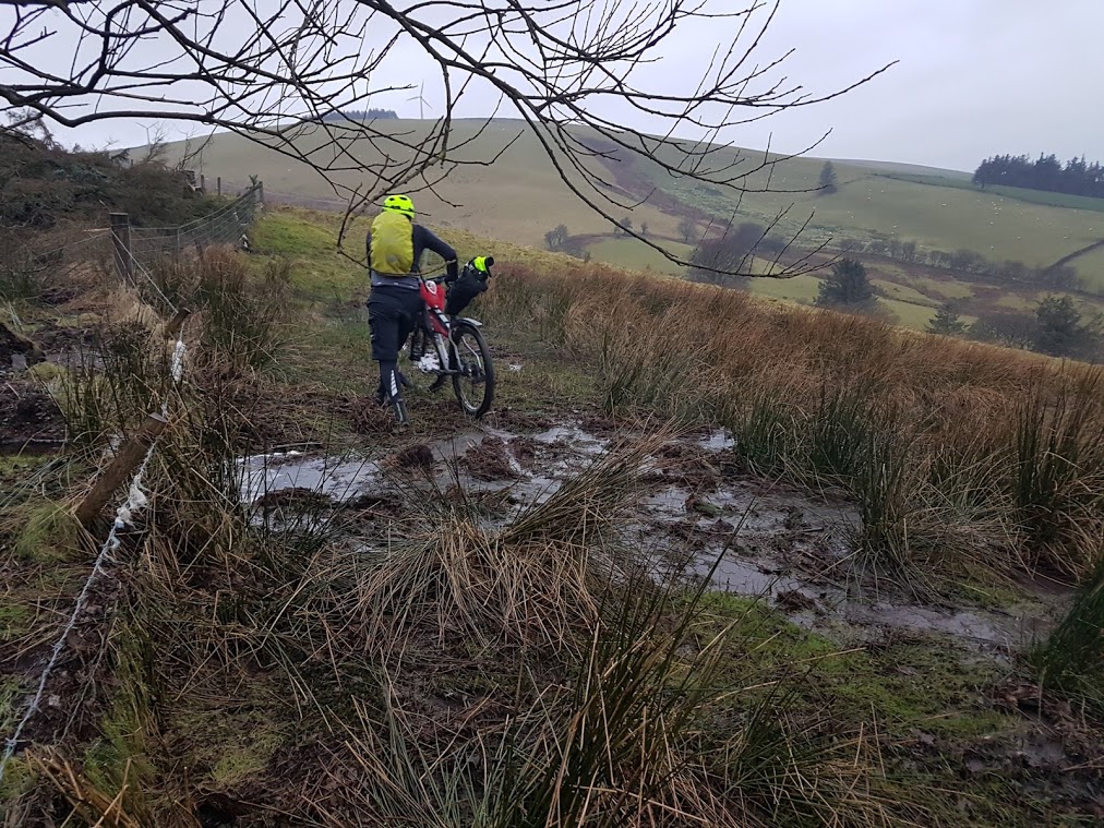
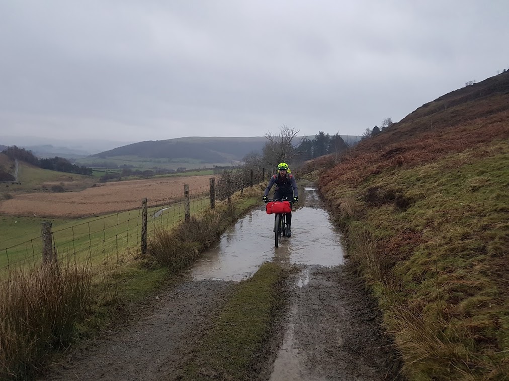
My only real grumble was after using it on the The Bear Bones 200 . Not all of the trails/fire roads were present on the maps (although all the designated rights of way were) which made some junctions a little more fraught than you’d like!

Summary

It is a fabulous device, particularly for road use and only with minor caveats for use off-road. The price is comparable to a similarly specified Garmin and considerably less than the latest range topping Edge. If the aforementioned navigation quirks are not a deal-breaker you’ll find the reliability and ease of use more than adequate compensation.

Saturday 20 January 2018

Dirty Kanza: A Veteran’s view – David Markman

 For over a decade the Dirty Kanza 200 has been the gravel event against which all others are compared. Having rocketed from a handful of riders in 2006 to over 2,000 entrants in recent editions it’s clear that there is something special about the race.

For many, 200 miles in the blazing Kansas sunshine is perhaps something to experience once, and then relive the memories with your feet up. David Markman though, is no stranger to Emporia, as in June 2018 he’ll be lining up for his fourth DK200. We spoke to him to find out just what the attraction was and how he’d be preparing…

Despite the DK200 having an almost legendary reputation for being a tough ride you’ve ridden it multiple times, what keeps drawing you back?

After my first year in 2015 where I walked more miles with my bike than I rode I was done with the Dirty Kanza, I had my one finish and was done. The following year I had my sights set on the Tour Divide and what a better warm up for my legs than to do DK 200 just a week before I left for the grand depart, so now I had 2 finishes under my belt.

There are two awards a person can get achieve during the DK 200 other than finishing, one is racing the sun-this means you have to finish the 200 mile gravel race before the sun sets, the other is to have five 200 mile finishes–earning you a 1000 mile cup. So in 2017 my goal was to beat the sun and I did by a large amount of time, now I need two more finishes to earn my 1000 mile cup and hopefully 2018 will be one more finish.

So my draw to the DK 200 has changed a lot throughout the years, and after my five finishes I’ll have to look for a new incentive to draw me back to the Flint Hills of Kansas.

David Markman rider interview

Momentary break from the aero position!

How will you train and prepare for the event?

I ride thousands of miles every year most of the time on loaded bikes while bike packing, I will get a few multi hundred mile rides in before a big event like Dirty Kanza just to test the legs and contact points (hands, feet, sit bones).

I focus a lot on recovery after a workout, this means I can continue to ride hard workouts all week and not have loss of performance.

Have you adapted your strategy, kit or mindset based on your earlier rides?

Yeah totally! I am always learning each and every ride or race. Early on I would overpack food or over dress – these days I race with the only the minimum of things I need. I know how much water and how many calories I need for X amount of miles while in between checkpoints.

A race like Dirty Kanza is much easier if you rely on the checkpoints for fuel and resupply rather than carrying too much food and water.

David Markman Dirty Kanza veteran

Taking on fluids at Checkpoint 3, 162 miles in.

What advice would you give to a first-timer?

Start drinking plenty of water a few days before DK. It’s summer and Kansas is hot and dry and you will dehydrate faster.

The energy is high and there are a lot of people at the starting line – don’t get caught up in it and cause a crash ending your DK before it starts.

Think about wearing a hydration bladder on your back, even if you don’t like wearing things on your back, it is way easier to reach for a drink tube than it is to reach for a bottle.

What are your hopes for the 2018 event?

Just finish. Haha! Last year I beat the sun and didn’t get a print – they didn’t make enough so maybe beat the sun and get a print. (Editors note: This refers to a limited edition art print)

How will you fuel yourself on the ride?

I use Infinit Go Far Nutrition drink mix in-between check points and I will have a few Gu energy gels and an energy bar with me just in case. At the checkpoints I eat a lot of Jimmy Johns subs, they are quick and easy and taste good when you burp them back up. Ha!

My best advice is to try different foods now while you are out riding and training for DK. Figure out what works well when you have been pushing your body hard and not just sitting on your couch.

David Markman dirty kanza 2018

Still 40 miles to ride!

After such a punishing event what will you do to aid your recovery?

Infinit Nutrition makes a recovery mix called Nocturne it contains Tryptophan which helps me sleep. After a big event my legs are still firing and sleeping is hard. I have had the best luck with this mix.

I also use Elevated legs, large sleeves that fill and release with air helping to push sports waste out of my muscles and a lot of foam rolling. When I get back home I always book a full body massage; like three hours and after that my body will be good to start riding again.

Finally, as the DK200 can be difficult to get an entry for, which other events would you recommend?

Oh that’s a hard one! There are so many events these days to pick from, if you are looking for something out of the ordinary I would recommend the Gravel Worlds in Lincoln Nebraska (150 miles) JP’s Gravel Pursuit in Island Park Idaho (120 miles).

Maybe for something longer, try the Alexander In Minnesota (380 miles). A good resource I use for events in the USA is the Gravel Cyclist calendar as it has most of the gravel events going on.


When not riding, David is a pretty handy photographer. Give his site a visit here:  https://markmanoutdoorphotography.com

Tuesday 16 January 2018

Epic ride review: Bearbones Bikepacking Winter Event- The Cafe Racer


A week agI told you about my plans for the Cafe racer, and we all know about the best laid plans…

After a sub-standard fry up at Newtown Tesco, we rolled into Llanbrymair. Dee, half of the Bearbones Bikepacking team, unfazed by the grey skies, cheerily pointed us to a parking space and we went in to sign on.

Stu (the other half of the Bearbones team), stopped burning toast for a moment to pour us a cuppa and hand over the legendary winter event gift. As the theme was Café Racer the insulated stainless coffee cup made perfect sense. Cuppa in hand, we made the customary nods to fellow riders along with quick chats about routes and planned distances.

HITTING THE TRAIL

As this was James Pearson’s first bike-packing outing we decided we should hit the trails sooner rather than later so we could get to the eponymous Café and on to a decent bivi spot in good time. It’s good to start with enthusiasm from Llanbrynmair as it’s a 10km road climb to Dylife & Staylittle where the route options open up.

We’d opted to go through Hafren Forest, it’s the quickest way to get off the roads (not that they are that busy in Powys!) and where there are a multitude of trails. We followed the River Severn south and then east until we reached Llanidloes.

The weather was much kinder than expected so we passed right through and up a stiff climb towards Pegwyn Mawr. A quick rest to take in the view and we picked up the Glyndwr Way that would take us into Bwlch-y-Sarnau and the Glyndwr Way Café.

Rest above Llanidloes

Quick breather after the climb out of Llanidloes

At the Glyndwr Way Café the ever cheery volunteer staff welcomed us like old friends, staying open especially for the event. We had a complimentary cuppa while deciding which of the many cakes to have after a warming bowl of soup.

If you find yourself riding the Trans-Cambrian, or another route in the area it’s definitely worth making a detour to Bwlch-y-Sarnau. Naturally when it’s cold and wet outside it’s tempting to stay in the warm and chat but we decided to push on as the light rain might have been about to get worse!

The Glyndwr Way Café

The Glyndwr Way Café

NEXT STOP, BIVI SPOT

The fast descent from the Café into Pant-y-Dwr rapidly cooled us down but we soon got the opportunity to warm back up with a tough climb up to Bryn Titli. The cracking of icy puddles acted as a reminder of how cold it had remained all day.

As we approached the plateau the gravel double track soon gives way to the Mid-Wales classic, the Phantom Bridleway!

Bridleway view

Classic Mid-Wales Bridleway,,,

Yes, there’s something marked on the map, there may even be signposts, but there’s no evidence of anyone having passed through on hoof, wheel or foot! Naturally as progress slowed we were treated to more rain.

The last couple of KM to our bivi spot was a mixture of pushing, barely riding a couple of pedal strokes, carrying over fences, and carefully placing your feet so as not to sink into the bog.

We aimed for a small clump of trees and in the dying light could see the outlines of a small hut; it was here that we had planned to spend the night.

Don’t come to Wales and expect to keep your feet dry!

DON’T BE A DICK…..

That’s the first, and most important rule of bike-packing. Wild camping in England & Wales is strictly speaking illegal but is generally tolerated in remote areas. Arriving late, leaving early and leaving no trace goes a long way to keeping landowners happy.

At our chosen bivi-spot there is a small wooden building with room for three or four occupants and their bikes. It doesn’t appear to see much use and I haven’t a clue who it belongs to, but following the most important rule would mean you wouldn’t know that we had stayed there either.

Room with a view

We laid out our kit, fired up the Alpkit Kraku stove and got on with boiling water for our meals. With our appetites satisfied we got our heads down and set an early alarm.

THE MORNING AFTER…

By bike-packing standards we’d had a great night’s sleep safely sheltered from the elements in our little hut. Added to that, packing away dry rather than rain soaked kit aids a speedy departure. Another bonus was that while day one had been overcast we were treated to a glorious sunrise!

Riding across the plateau

Just sheep and wind turbines for company

The descent down to the River Wye is steep and with the rain, the surface was like custard. Dragging brakes started to steam as our speed was restrained due to the lack of grip.

We followed the Sustrans route through Llangurig and into Llanidloes where we visited Café number two: The Travellers Rest. As well as being open early on Sunday, is very accommodating to mud spattered and dishevelled bikepackers and serves up a mean fried breakfast.

Travellers rest cafe Llanidloes

Muddy cyclists welcome!

Fuelled now to the finish we took the scenic route back between Llyn Clywedog and Hafren Forest. While beautiful, it features some sharp climbs but the views above the dam make every ‘into the red‘ effort worth it!

Ample reward for the effort to get there

Popping out of Hafren we reached a junction at the head of the reservoir. Mysteriously it indicates that Llanidloes is 9 miles away whichever turn you make! We headed right as it would take us back to Llanbrymair via the way we came, but this time downhill all the way! Those last few miles flew past almost effortlessly as gravity and a second wind pushed us along.

Just as with the day before Stu & Dee were on hand serving up tea & toast while we shared our ride stories. Once safely back we also felt confident enough to comment on how mild the weather had been for January in Wales without fear of jinxing ourselves.

I’m certain James enjoyed his first bike-packing experience, and on the drive home we discussed plans for a Coast to Coast attempt during the Summer. Before then, some local trips and a return to Mid-Wales for the Welsh Ride Thing will provide further opportunities to hone his craft.

Tuesday 9 January 2018

Bearbones Café Racer: The Planning Process


Typical Bear Bones 200 Trail

Back in November we posted news on a bikepacking event taking place in January 2018, The Bearbones Café Racer. If you want to enter, sorry but you’re too late! You can read the full details in our news piece but the summary is as follows:

On Christmas Eve, three weeks before the event, you will receive OS Map grid references that you’ll use to plot a cross country route from the start in Llanbrynmair in Mid-Wales to a mystery location. The event name always holds a clue as to where you might be heading!

A couple of weeks after the news item we spoke to first time bikepacker James Pearson who, having seen the article, signed up for the Café Racer and invited us along to join him in the preparation and planning for his first bike packing adventure. Nigel Leech picks up the story and formulates a plan…

First things first…

The first step was to make sure that the quantity of mince pies and sherry consumed on Christmas Eve didn’t lead to missing the email from the event organiser. When the Grid References and the destination were made public I followed my usual process. Get out the paper maps and mark all the way points with small stickers.

James meanwhile, sat down and carefully sorted out his kit for the ride and how best to pack it…

bearbones bikepacking kit

All this WILL fit into the bags…

bearbones bikepacking loaded bike

Ready for the Cafe Racer. James Pearson’s carefully loaded bikepacking rig.

I’ve been a GPS and Online GPX user for a number of years but I still don’t think anything beats opening out a big OS map to get the big picture about the area you plan to ride through. Choosing your route between the way points comes down to a compromise of the following:

  • Time/Distance: How much time do you want to put in the saddle?
  • Terrain: While Off-road riding is generally more scenic, it is also usually slower going, will you cover the distance in the time you have?
  • Personal experience: If you’ve been to the area before are there areas you know to avoid?
  • Likely conditions: A route that would be great in the Summer could be awful in Winter. Waterlogged trails become an exercise in carrying and pushing and that stream you could hop across has become a full blown river
  • Resupply points: How self-reliant will you be? Do you need to consider resupply points or will you carry all your food?
  • Bivi spot: You need to find a spot that suits your shelter system and that exhausts you to get there. You also need to think about how far you are prepared to travel the next day to get back to the start.

Putting a plan together…

With all these in mind my ideas were as follows:

As this was James’ first bike-packing trip it needed to an adventure while still being enjoyable! Heading South from Llanbrynmair involves about 10 km of climbing. Better to get that out of the way on Tarmac, it’s a quick win and will warm us up on what will almost certainly be a cold day! A couple of km further and we pass through Staylittle (one of the last places to get web access in UK!) and then into Hafren Forest.

Hafren is teaming with trails from singletrack, to tarmac. We’ll ride 15km through the Forest to Llanidloes. We don’t plan to stop but this is a contingency in case the weather takes a turn for the worse.

From Llanidloes it’s another 15km to the eponymous Cafe of the event, on the Glyn Dwr Way in Bwlch-y-Sarnau. We’ll swap from bridleway to tarmac on this section to help maintain our average speed and reduce any potential loss of morale from sodden trails.

Our plan is to head directly west from the Cafe towards the Wind Farm above the River Wye. Depending on conditions there are Bivi spot options among the trees on the climb to the summit, or on the plateau upon which the wind farm is sited. If it seems too wild on top then the gravel access roads can have us down by the 8-81 Sustrans route that follows the Wye and has a areas that are suitable for night’s bivi.

Day two is unashamedly planned to be easier. We’ll take the Sustrans route to Llanidloes for a well deserved fry-up and then back into Hafren Forest, but this time skirting around Llyn Clywedog to reach Staylittle. Here we can decide to take the road back (10km of descent!) or head up into Dylife and take the bridleway descent into Pennant before rejoining the tarmac.

We’ll find out how our intrepid duo got on at the Bearbones Café Racer next week. Stay tuned!

Cafe Racer Logo